Best hiking, trekking in Switzerland 2026 runs April–October; high-alpine treks peak July–September, while low-altitude routes are great April–November.
At a glance | Don’t Miss — 15 Hiking & Trekking Trails, Switzerland
- Best season: April–November overall; peak alpine window mid-June → September; autumn colours are best in Sep–Oct.
- Top trails: Männlichen → Kleine Scheidegg (Panorama Trail), Five Lakes (Zermatt / 5-Seenweg), Hohtürli → Oeschinensee (Kandersteg region), Aletsch Glacier Panorama / Aletsch Arena routes (UNESCO views).
- SBB tip: Use a Swiss Travel Pass or Half-Fare Card and check SBB.ch for train/PostBus timetables and last-return times to avoid being stranded after mountain hikes.
- Daily budget: Example estimate CHF 60–150/day for food + local transport (huts/hotels, mountain lifts and guided trips are extra). Adjust higher for overnight stays and paid excursions.
- Hut & booking: SAC huts and popular mountain huts fill fast in summer — reserve well in advance (weeks to months), carry a liner, small cash and a power bank for remote stretches.
- Confirm mountain lift & cable car timetables (seasonal closures are common outside Jul–Sep).
- Book SAC huts or private huts 4–8+ weeks ahead for summer weekends; keep confirmation screenshots and contact numbers.
- Carry layered clothing, sturdy boots, refillable water, sunscreen, a power bank and small CHF notes for hut or lift purchases.
- If making multi-day plans, check route difficulty and altitude gain; hire a guide for glacier or exposed high-route sections if unsure.
The Zurich Prestige Series
Curating the pinnacle of Swiss hospitality. Discover Zurich’s most exclusive lakeside retreats and historic architectural sanctuaries.
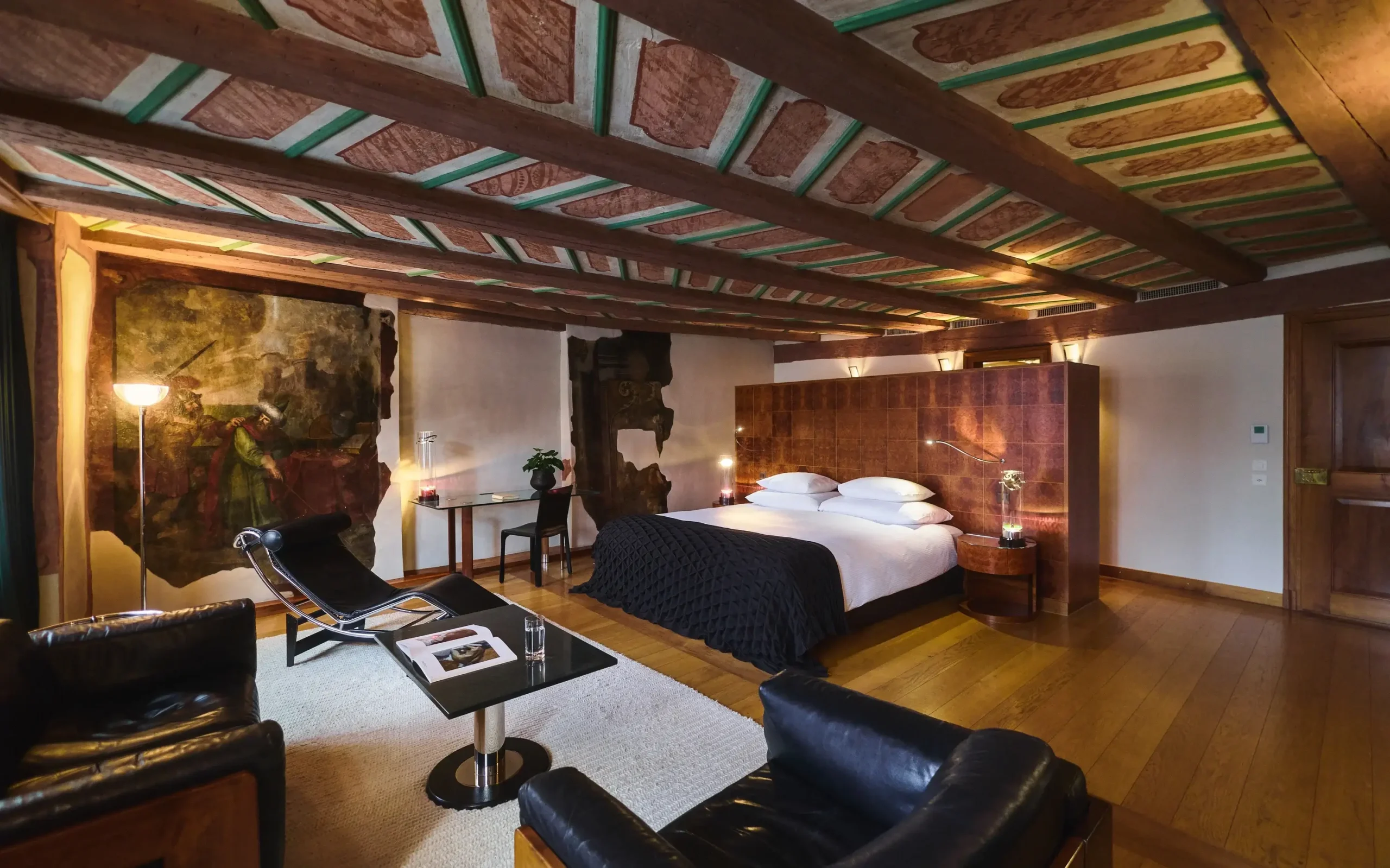
Residences by Widder
Exclusive, sprawling residences blending medieval architecture with avant-garde design in the heart of Zurich’s Old Town.
Reserve Private Residence
Baur au Lac
An undisputed legend of Swiss hospitality set within its own private park overlooking Lake Zurich and the Alps.
View Exclusive Rates
La Réserve Eden au Lac
An imaginative, yacht-club-inspired oasis reimagined by Philippe Starck, offering vibrant elegance on the lakeshore.
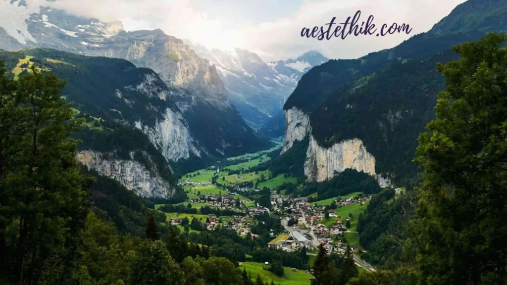
Check AvailabilityExplore Switzerland’s Alpine Hiking & Trekking Trails ~ Over 65,000 km for Every Level
Embark on an unforgettable hiking adventure: Switzerland boasts 65,000+ km of waymarked trails for all skill levels. From gentle valley paths to rugged alpine ridges, virtually every corner of the country is accessible on foot. Whether you seek a leisurely lakeside walk or a challenging multi-day trek, there’s a route for you. Trails are color-coded: yellow = easy, red-white-red = mountain hiking, white-blue-white = difficult alpine terrain (not covered here). Key takeaway: Switzerland’s dense trail network means you can often plan loop hikes connecting villages, with train or boat transfers.
- Quick facts: ~50,000 signposts, 2,000+ volunteer trail workers; major national routes (Via Alpina, Alpine Passes Trail) span the Alps.
- Terrain: Alps (80% of land area), Jura range, plateaus. Expect steep climbs in mountains.
- Weather & Seasons: Hiking season broadly April–October. High alpine passes open mid-June onward (check snow conditions). Avoid avalanche season (Nov–Mar) above treeline; consult SLF avalanche bulletins. Summertime (Jul–Aug) offers longest daylight, most open trails; Autumn (Sep–Oct) brings fewer crowds and spectacular colors.
Checklist:
- Map/GPS (download GPX; official SwissTopo or Komoot)
- Hiking boots + layers (mountain weather is changeable)
- Sun/rain gear, snacks, water
- Swiss Travel Pass/Half-Fare card (public transport)
Best Hiking Seasons & Safety ~ April–November Adventures, Beware Winter Avalanche
Switzerland’s hiking is prime from late spring through early autumn. By June–September, trails up to ~2,500m are mostly snow-free. Spring (Apr–Jun) can still see snow on higher passes and soggy trails, but flowers bloom. Autumn (Oct) has cooler days and golden larches. Winter (Dec–Mar) is generally unsuitable for hiking at altitude; heavy snow and avalanches (see SLF data: only ~4% of avalanches occur Jun–Oct, but caution in shoulder seasons). Always check local forecasts and avalanche warnings.
- Spring tips: Lower trails may be green; higher routes icy. Some huts open late May.
- Summer tips: Popular trails can get busy mid-day. Book huts or mountain hotels in advance. Be aware of thunderstorms (common July–Aug afternoons).
- Autumn tips: Golden larch forests (late Sept) are stunning. Some remote huts close mid-Oct. Start hikes early as days shorten.
Short answer: Late spring through fall offer the safest, most enjoyable conditions. In winter/early spring, stick to valley routes or use winter hiking trails. Always check trail opening updates (SwissTopo app) and avalanche bulletins for safety.
The Geneva Gold Standard
From the historic banks of Lake Geneva to ultra-private wellness sanctuaries, experience the pinnacle of Swiss hospitality.

The Woodward
Geneva’s first all-suite hotel. A lakeside masterpiece featuring Michelin-starred dining and world-class Guerlain spa facilities.
Reserve Your Suite
Four Seasons des Bergues
The oldest grand hotel in Geneva, blending historic elegance with panoramic views of the Jet d’Eau and the Alps.
Unlock Rates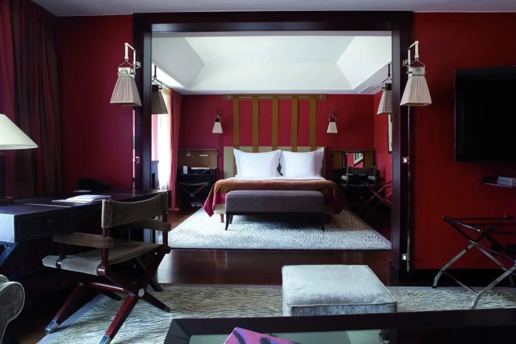
La Réserve Genève
Set within a private 10-acre park, this lakeside resort is a haven for wellness, featuring the renowned Nescens Spa.
Check AvailabilityEssential Gear & Preparation for Swiss Hikes | Trails, Maps, and Logistics
Prepare like a pro: Hiking gear is key to enjoying Switzerland’s trails. Sturdy boots with ankle support are a must for mountain terrain. Layered clothing (moisture-wicking base, insulating mid-layer, waterproof shell) handles Swiss weather swings. Bring sun protection (hat, sunglasses, sunscreen) even in cooler months.
Plan carefully: Study maps and trail data. The official SwissTopo maps (1:50k scale) cover every trail. The SwissTopo app and SwitzerlandMobility app provide digital maps and routing. You can download GPX tracks from these or from popular platforms (Komoot, AllTrails). For example, Swisstopo (paper or app) offers offline topographic maps, while SwitzerlandMobility shows the full trail network offline.
- Navigation: Markers/signs are excellent, but carry a map/GPS. High passes may have snow in shoulder seasons.
- Checklists: Pack first aid, headlamp, whistle. A power bank (remote hikes often lack outlets).
- Fitness: Many Swiss hikes are steep; train with elevation gain. Elevators/cable cars (like Dachstein, Klewenalp) can shorten the hardest climbs.
Quick tip: Many hut-to-hut hikes require advanced booking (see below). Always respect trail closures (due to wildlife or erosion) by checking official swisshiking.ch or myswissalps.com updates before you go.
Mountain Huts & Accommodations | SAC Huts Booking & Hut Etiquette
Switzerland has a cozy network of mountain huts. 153 Swiss Alpine Club (SAC) huts with ~9,000 beds dot the high Alps. Most are staffed in summer (mid-June to mid-Oct), offering dorm beds and meals (no electricity or heating in many). Book in advance! Huts fill quickly on weekends. Online reservation is recommended.
Photo: Boschhütte (Bosch mountain hut) at Arosa, one example of many SAC refuges.
Rooms are simple: expect dorms, wool blankets, simple meals (soup, pasta, local dishes). Prices ~CHF 80 for a dorm bed. Carry cash (some huts accept cards, but not all).
- When to sleep up: Use huts to tackle multi-day hikes or early starts (e.g. summit sunrise).
- Etiquette: Shower rarely available (if at all). Don’t wander off with your gear; re-order tables/trays. Quiet hours typically 10pm-6am.
- Gear: Bring a liner sheet or sleeping bag. A headlamp is useful.
Hut-to-hut routes (e.g. Alpine Passes Trail) are rewarding. Remember: reserve early, especially in August. Many have online booking systems, and English info on SAC site. For families, some huts have smaller rooms or games; check SAC site for details.
Ready to stay in the mountains? Use the SAC route planner or SwitzerlandMobility’s hut list to find available spots and plan your overnight routes.
The Zermatt Alpine Series
Curating the pinnacle of high-altitude luxury. Discover Zermatt’s most exclusive mountain retreats and unmatched Matterhorn views.
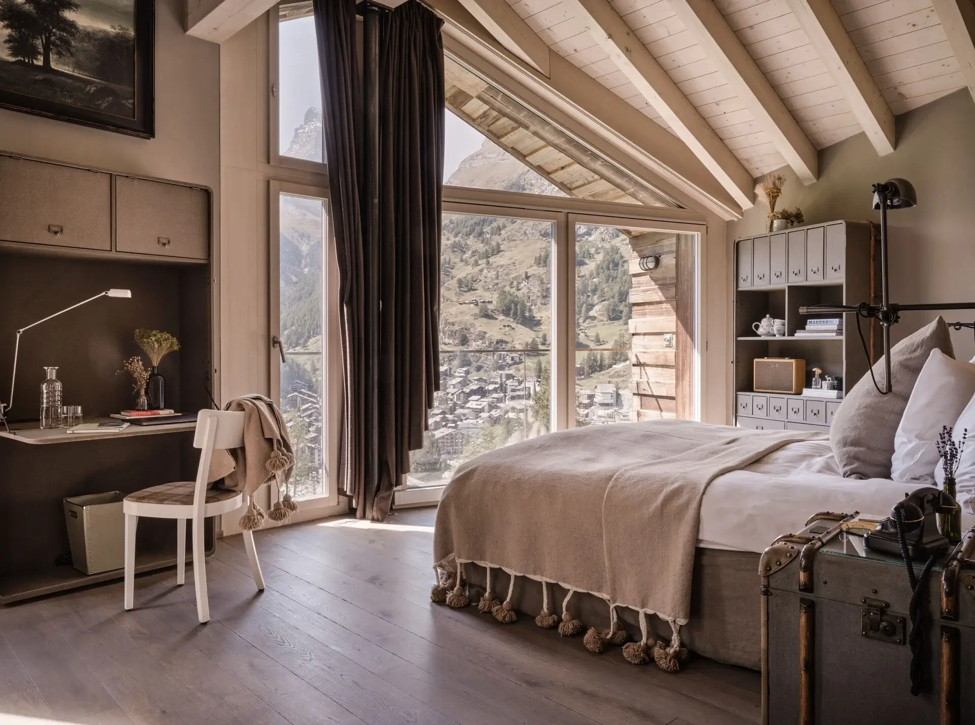
CERVO Mountain Resort
A conscious, modern retreat blending sustainable luxury with ski-in/ski-out access and breathtaking Matterhorn panoramas.
Discover CERVO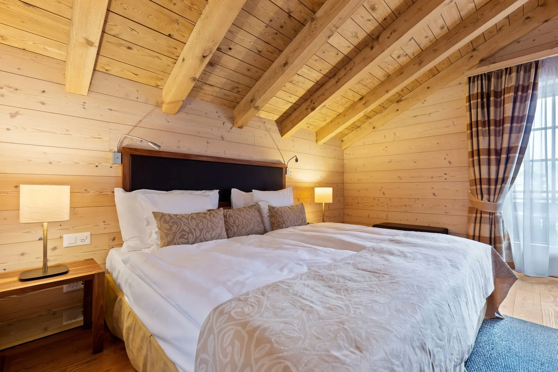
Grand Hotel Zermatterhof
A masterclass in traditional Swiss hospitality. Arrive by horse-drawn carriage to this legendary 19th-century palace.
Step Into History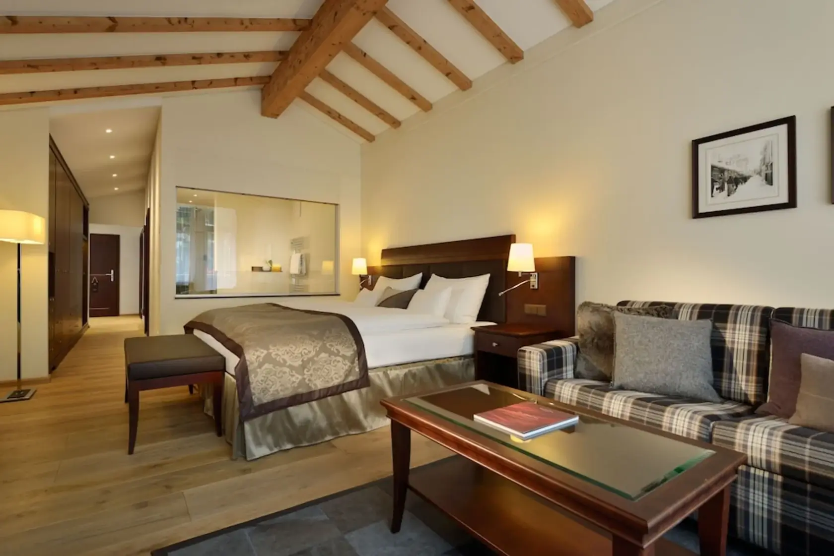
Mont Cervin Palace
A legendary member of the Leading Hotels of the World, delivering timeless Swiss charm and carriage arrivals since 1852.
Reserve the PalaceBook Flights To Switzerland
When you travel, your time and comfort are your most valuable assets. That is why we recommend bypassing the hassle and booking your premium flights directly through below widget. Known for its powerful search technology, Kiwi makes securing the perfect, high-end itinerary effortless.
Whether you are flying for a crucial business meeting or a luxury getaway, booking the right flight sets the tone for your entire trip. We always recommend prioritizing direct flights in Business or First Class. Direct routes save you hours of exhausting layovers, while premium cabins offer priority boarding, exclusive lounge access, lie-flat seats, and superior dining. You arrive at your destination refreshed, respected, and ready to go.
Ready to secure your seat? Use the search tool below to find the best premium routes. Here is exactly how to tailor your search for the ultimate travel experience:
Your Step-by-Step Guide to Booking
1. Choose Your Journey Type Start by selecting either a One-way or Return trip at the top of the search box.
2. Upgrade Your Experience (Crucial Step) Click the cabin class dropdown and select Business Class or First Class. Skip the economy section—investing in a premium cabin ensures you get the exceptional service, extra space, and luxurious amenities you deserve from takeoff to touchdown.
3. Add Your Travel Companions Select the number of passengers traveling with you. Ensuring everyone is in the same premium cabin guarantees a cohesive and relaxing trip for your whole party.
4. Select Your Baggage Requirements Choose your checked and cabin baggage. A major perk of flying Business or First Class is that generous baggage allowances are almost always included, so you never have to pack light unless you want to.
5. Choose Currency: Select currency which you prefer for better understanding.
6. Enter Your Departure and Destination Input your home airport and where you are headed. Pro tip: Look for the direct flight options that populate. Direct flights dramatically reduce your travel time and minimize the risk of lost baggage or delays.
7. Search & Secure Your Flight Hit the Search button! This will instantly aggregate the best premium, direct routes available. Choose the schedule that fits your life, and complete your secure booking in just a few clicks.
Start Your Search Now:
Getting Around: Trains, Buses & Cable Cars for Hiking Access
Swiss public transport makes hikes accessible. The Swiss Travel Pass (all-aboard travelcard) covers unlimited trains, buses, boats – and often gives huge discounts on mountain railways/cable cars. With a travel pass or Half-Fare Card, you can reach trailheads and even summit stations with ease (Jungfraujoch, Gornergrat, etc.).
Photo: Scenic Swiss hiking trail (Pilatus area). Many trails have valley ends reachable by train or cable car, making “near me” routes possible.
- Example: Use SBB to reach Grindelwald or Zermatt, then cable car to start a high trail. PostBus lines serve remote valleys (ask SBB/PostBus website for bus schedules to trailheads).
- Travel tips: Book peak-hour trains/cable early (some mountain trains sell out). Check timetables for last return trains. In summer, look for “hiking day tickets” or regional passes.
- Local shuttles: Some cable cars run on-demand; others (e.g. to Schynige Platte) run hourly. Always carry some coins/SwissPay for small postbus fares on remote runs.
Short answer: Switzerland’s rails and buses can get you to most trailheads efficiently. Plan with SBB’s online planner. From there, all trails (“near me”) are signposted.
Hiking Route Planning & Apps | SwissTopo, SwitzerlandMobility, Komoot
Plan your hike with technology! The Swisstopo app (iOS/Android) provides official topo maps with GPS. It has 1:25k/50k maps, route planning, and GPX export. The SwitzerlandMobility app shows the entire national hiking network with ferry and train connections (even offline).
For crowdsourced routes, Komoot and AllTrails are popular. They offer GPX downloads and community reviews. Always cross-check crowd-sourced tracks with official maps (trail names can overlap).
Tools comparison:
| Tool/App | Platforms | Key Features | Notes |
|---|---|---|---|
| SwissTopo app | iOS, Android | Official topo maps, route planner, GPX | High-detail maps; offline use; free basics |
| SwitzerlandMobility | iOS, Android | All official trails, ferries, trains | Full Switzerland hiking network; offline; free |
| Komoot | iOS, Android | User routes, GPX export, turn-by-turn nav | Popular for custom routes; paid maps |
| AllTrails | iOS, Android | User-submitted trails, reviews, GPX | Good trail photos, requires account |
| Outdooractive | iOS, Android | Trails worldwide, topomap, offline | Similar to Komoot; strong European coverage |
| SAC Route Portal | Web | Official SAC hut tours and maps | Route details for high alpine tours |
With these tools, you can find “hiking trails near me”. Enter any Swiss location, and you’ll discover nearby marked routes. Download GPX from SwitzerlandMobility or Komoot for on-trail navigation.
Switzerland’s Top 15 Hiking & Trekking Trails
| Trail (Region) | Distance / Time | Highlights | Difficulty / Season |
|---|---|---|---|
| 1. Panorama Trail: Männlichen–Kleine Scheidegg (Bernese Oberland) | ~10 km / 3h | Panoramic views of Eiger/Mönch/Jungfrau | Moderate; June–Oct |
| 2. Hardergrat Ridge (Interlaken) | ~24 km / 8h | Exhilarating ridge with Lake Brienz views | Difficult; July–Sept |
| 3. Hohtürli Pass via Oeschinensee (Bernese Alps) | ~17 km / 6h | Summit Hohtürli (2,778m), alpine lakes | Challenging; July–Oct |
| 4. Five Lakes Trail, Zermatt | ~9 km / 3h | Five mountain lakes & Matterhorn reflections | Easy-Moderate; May–Nov |
| 5. Aletsch Glacier Panorama (Jungfraujoch–Konkordiahütte) | ~8 km / 4h | World’s longest glacier; glacier plateau | Moderate; June–Sep |
| 6. The Swiss Path (Lake Lucerne) | 35 km (sections) | Panoramic lake views, historic Rütli meadow | Easy-Moderate; Apr–Nov |
| 7. Lavaux Vineyards (Lake Geneva) | ~11 km / 3h | UNESCO terraced vineyards | Easy; Mar–Oct |
| 8. Creux du Van (Jura) | ~14 km / 5h | Natural stone amphitheatre, wildlife | Moderate; Apr–Oct |
| 9. Monte Tamaro – Monte Lema (Ticino) | ~18 km / 6–7h | Dual peaks with lake/Alps panorama | Moderate-High; May–Oct |
| 10. Alpstein Panorama (Hoher Kasten, Appenzell) | ~14 km / 5h | 360° views from Hoher Kasten chairlift | Moderate; May–Oct |
| 11. Gastlosen Circuit (Fribourg/Bernese) | ~20 km / 7h | Jagged limestone peaks (Swiss “Dolomites”) | Difficult; Jun–Sept |
| 12. ViaRhôna (Stage on Rhine, Basel–Schaffhausen) | ~25 km / 8h | Scenic Rhine rapids, historic towns | Easy-Moderate; Apr–Oct |
| 13. Swiss National Park (Graubünden) | up to 15 km sections | Alpine wildlife, strict nature reserve | Moderate; May–Oct |
| 14. Pilatus Golden Round Trip (Central Switzerland) | 24 km / 8h | Cable car ascent + mountain loop | Moderate; May–Oct |
| 15. Matterhorn Glacier Trail (Zermatt) | 9 km / 3h | Views of Matterhorn and glacier lakes | Easy; Jun–Oct |
Table: Overview of top Swiss trails (distance/time are approximate). For full trail details, see each section below or official Swiss hiking sites.
Each of these iconic routes is covered in detail in the following sections. They span Switzerland’s regions and offer a variety of landscapes – from high Alps to Jura, from lakesides to vineyards.
1. Hiking & Trekking Panorama Trail: Männlichen → Kleine Scheidegg (Bernese Oberland)
Experience the classic Bernese Oberland panorama. Starting at the Männlichen cable car station, this hiking trail gently traverses the ridge to Kleine Scheidegg, offering spectacular frontal views of the Eiger, Mönch and Jungfrau. The path is well maintained and family-friendly, with wildflowers in summer.
- Distance/Ascent: ~10 km, ~700m up/down. (Cable car to Männlichen saves 700m ascent; descent continues to Grindelwald or Wengen).
- Highlights: Panoramic views the whole way; benches at viewpoints; Alpenrose meadows in June–July.
- Logistics: Start via cable car from Grindelwald or Wengen to Männlichen. Finish at Kleine Scheidegg (train station to Interlaken/Zermatt).
- Hut/Facilities: No huts on trail; restaurants at both ends.
At a glance: The trail is well-signposted (yellow). Summer weekdays are quieter. Bring a camera – this is one of Switzerland’s most famous views.
2. Hiking & Trekking Hardergrat Ridge (Interlaken Area)
For experienced hikers: the Hardergrat is a thrilling ridge hike above Lake Brienz. Starting from Harder Kulm (take Harderbahn funicular), follow the narrow crest all the way to Augstmatthorn. It’s exposed in sections and not recommended for those afraid of heights.
- Distance/Time: ~24 km, 1500m ascent, 8–10 hours.
- Highlights: Endless panoramas over Lake Brienz and the Bernese Alps; isolated alpine meadows.
- Difficulty: High. Sections T4-T5 (scrambling). Good footwear essential; a slip can be dangerous.
- Tips: Begin very early (day is long); pack light. Spring can leave snow on the ridge; best done July–Sept. Option to descend earlier via car/bus from Brienzer Rothorn.
3. Hiking & Trekking Hohtürli Pass via Oeschinensee (Bernese Alps)
This is a classic cross-Alps trek. Hike from Kandersteg (or ride funicular to Oeschinen for shorter route) up to beautiful Lake Oeschinen, then cross the Hohtürli Pass (2,778 m) into Gasterntal. Descend to Kandersteg or continue to Blüemlisalp Hut.
- Route: Kandersteg – Oeschinensee – Hohtürli – Kandersteg loop.
- Distance/Ascent: ~17 km, 1500m. (~2,778m summit).
- Highlights: Turquoise Oeschinensee (glacial lake) and waterfalls; high mountain pass with glacier view; wild cows on alpine pastures.
- Difficulty: Demanding but non-technical. The pass has ladders; sure-footing needed.
- When: Pass is usually snow-free July–Oct. Early hikers start around 6am.
This hike rewards with one of the most scenic passes in Switzerland. Allow 6–7 hours; self-guided GPS tracks are available on SAC route portal and Komoot.
4. Hiking & Trekking Five Lakes Trail, Zermatt (Matterhorn Area)
The 5-Seenweg is a picturesque loop: hike from Blauherd (accessible by lift) to the five mountain lakes reflecting the Matterhorn. Each lake offers a unique view: Stellisee (famous for its glassy Matterhorn reflection), Grindjisee, Grünsee, Moosjisee, and Leisee.
- Distance: ~9 km circular, 400m ascent (if Blauherd is your start).
- Highlights: Alpine lakes with mountain backdrops. May–Oct is best (snow melts by June).
- Difficulty: Moderate; wide trails. Mostly family-friendly.
- Access: Cable car from Zermatt to Blauherd. Return via the same trail or descend to Sunnegga.
Bring a swim suit – some adventurous hikers cool off in the clear lakes! Average time ~3–4 hours including stops.
5. Hiking & Trekking Aletsch Glacier Panorama (Jungfraujoch → Konkordiahütte)
This high-alpine tour descends from the Jungfraujoch (3,454 m) across the Aletsch Glacier to Konkordiahütte (2,850 m). It’s mostly downhill across ice fields: a very scenic tour through one of the largest ice landscapes in the Alps.
- Route: Jungfraujoch station → Konkordiahütte (SAC).
- Distance: ~8 km, net descent ~600m.
- Highlights: Traverse vast glacial plateau (Konkordiaplatz); epic glacier views.
- Difficulty: Moderate technically (marked glacier trail with ladders up to hut); requires good weather. SAC rates it F (hiking on glacier with aid).
- Timing: Typically July–Sept. Always check glacier conditions (crevasses, bridges) via SAC or SLF updates.
This trail is unique: start at Europe’s highest train station and hike back towards the valley in a few hours. The SAC hut at the end is perfect for a nights’ rest before descending further to Fiesch or Mörel.
6. Hiking & Trekking The Swiss Path (Lake Lucerne)
A historic and scenic heritage trail. The Swiss Path commemorates 1291 (Confederation founding) and runs along Lake Lucerne’s shore from Rütli to Brunnen and beyond. You can hike sections or complete the trail in stages.
- Trail: Rütli – Beckenried – Buochs – Stansstad (via ferry connections). Total ~35 km; divide into stages.
- Highlights: Panoramic lake and mountain views; Rütli meadow (legendary Swiss founding site).
- Difficulty: Easy-to-moderate. Paths and boardwalks, gentle terrain. Suitable for families.
- Season: Mar–Oct (ferries and boats run). Buses connect segments (e.g. Brunnen-Fähre).
Each stage has boat/train links, making flexible hikes. Ferry between Morschach and Beckenried cuts out a road segment. The “Harderband tunnel” (artistic light tunnel) near Isleten is a modern highlight.
7. Hiking & Trekking Lavaux Vineyards (Lake Geneva)
This hillside wine trail offers gentle walking among UNESCO-listed vineyards. The classic route runs from St-Saphorin to Lutry, with stunning views of Lake Geneva and the Alps.
- Distance: ~11 km, ~440 m ascent (vineyard terraces).
- Highlights: UNESCO Lavaux terraces (since 2007); medieval villages (St-Saphorin); wine tasting.
- Difficulty: Easy. Well-marked. Portions are asphalt but mostly footpaths.
- Season: March–Oct (vineyards accessible; trains and boats link endpoints).
Enjoy rest stops at wine cellars or lakeside cafes. The path weaves through old stone villages and olive trees. In summer, trains and boats (Leman Express) ensure you can start/finish without repeating. A “Lavaux Express” train even runs on some days for tired hikers.
8. Hiking & Trekking Creux du Van (Jura)
A natural amphitheater of limestone cliffs 160m high. The Creux du Van is a panoramic rocky cirque. Several approaches exist; popular is from Noiraigue (passing cascades) or from Ferme Robert on the rim.
- Loop Distance: ~14 km (from Noiraigue via Ferme Robert, back via Combe Grède).
- Highlights: The amphitheater basin itself (frequent ibex sightings). Panoramic views into Val-de-Travers.
- Difficulty: Moderate; forest tracks and cliff-edge trails. Steep descent into valley.
- Best Time: May–Oct. Spring flowers or fall colors enhance the cirque.
No huts in immediate area – picnic-ready. Use bus to Noiraigue. Wrap your hike with a visit to nearby Taillères nature park or thistle fields.
9. Hiking & Trekking Monte Tamaro → Monte Lema (Ticino)
This cross-country two-summit hike in the Lugano Prealps delivers big views for less effort. Take the funicular to Monte Tamaro (1,962 m), then hike the ridge across Monte Lema (1,624 m).
- Route: Monte Tamaro – Rifugio Garzonera – Alpe Foppa – Monte Lema – Miglieglia.
- Distance/Ascent: ~18 km, 1000m up/down.
- Highlights: Views of Lake Maggiore, Lugano, and the Italian Alps. The funicular and cable car start at Rivera (Ticino, SwissTopo).
- Trail: Moderate, with marked alpine paths and forest. Return by train from Miglieglia.
Include a detour to the Church of Sant’Anna for alpine architecture. Picnic on ridge – the sky can feel as close as Mount Tamaro’s top observatory.
10. Hiking & Trekking Alpstein Panorama (Hoher Kasten, Appenzell)
An Alpine panorama trail in Eastern Switzerland. Take the cable car to Hoher Kasten (1,795 m) which has a 360° viewing terrace. Hike down via the Falken to Sämtisersee (lake) and Ebenalp area.
- Options: Cable car up/down, or loop: Hoher Kasten – Ebenalp – Seealpsee – Wasserauen (Stein) – return by cablecar/bus.
- Distance: ~12 km for loop (with lifts).
- Highlights: Sämtisersee lake, endemic ibex, Aescher cliffside inn (iconic).
- Difficulty: Easy-Moderate (well-developed hiking trails).
Hut/WC at Hoher Kasten station; mountain inn at Aescher (open June–Oct). Trails open around May–Oct. The area is family-friendly on the classic Ebenalp-Seealpsee route, but the ridge is dramatic.
11. Hiking & Trekking Gastlosen Circuit (Fribourg/Bernese)
Dubbed the Swiss Dolomites, the Gastlosen ridge offers rugged limestone scenery. The full loop goes from Jaun (FR) through torrent gorges, past alpine meadows, circling the peak.
- Distance: ~20 km loop, 1200m ascent.
- Highlights: Vertical cliffs, swirling Hügel (lava spires). The alpine hut Gastlosenhütte provides lunch/respite.
- Difficulty: Moderate. Steep sections, but trails are rocky.
- Season: Jun–Sept. Snow may linger on north faces until July.
Take the Jaun pass road to start; long day or overnight at Gastlosenhütte or Champery (just over French border). Note: Fragile environment; stay on trail.
12. Hiking & Trekking ViaRhôna Stage (Rhine, Basel → Schaffhausen)
This river trail follows the Rhine from Basel toward Lake Constance. Enjoy riverside woods, rapids, and cultural towns. Stage example: Basel – Pratteln – Rheinfelden – Waldshut – Laufenburg – Stein am Rhein.
- Distance: ~25 km per day (multiple stages).
- Highlights: Laufenburg castle ruins, Rheinfelden Old Town, Rhine Falls near Schaffhausen (deversion).
- Difficulty: Easy. Mostly flat paved/dirt paths along river.
- Season: Apr–Oct (May–Jul for waterfall flow).
Combine hiking with train transfers (many route links). The trail is well-signposted (sign with blue-green stripes) by SwitzerlandMobility. Sections suitable for bikes, too.
13. Hiking & Trekking Swiss National Park (Graubünden)
Explore Switzerland’s first national park (Engadin). The Nature Trail around Zernez or multi-day Alpine passes (Fuorcla) offer solitude and wildlife viewing (ibex, marmots).
- Popular: Chamanna Cluozza hike (moderate, panoramic).
- Strict Rules: No off-trail hiking or pets. Stick to marked routes.
- Season: Trails are snow-free by June. Park info center in Zernez provides maps and alerts.
For a bucket-list hike, consider the “Three Parks Hike” – linking Swiss, Stelvio and Adamello parks (grueling, for experts).
14. Hiking & Trekking Pilatus Golden Round Trip (Central Switzerland)
Not just a trail, but a classic combination: Boat across Lake Lucerne – cogwheel railway up Pilatus – hike across Pilatus to Fräkmüntegg – descent or cable car down.
- Highlights: Lucerne lake views, summit plateau, alpine lake (Tomlishorn area).
- Difficulty: Moderate. Much transport means less effort; hiking parts are gentle.
- Access: Only in summer (May–Oct) when cogwheel train runs. Purchase combined boat/rail tickets.
This iconic excursion mixes relaxation with short treks – a “must-do” for casual hikers wanting alpine views with minimal climbing.
15. Hiking & Trekking Matterhorn Glacier Trail (Zermatt Area)
A short but scenic path in Zermatt’s high Alps. It runs from Trockener Steg station to Schwarzsee (one way), skirting the Theodul Glacier and underneath the Matterhorn’s east side.
- Distance: ~6 km, mild descent.
- Highlights: Proximity to glacier, marmots, panoramic views of Matterhorn.
- Difficulty: Easy. High altitude but flat trail.
- When: June–Sept. The path is above 2,800m; snow possible outside summer.
Combine with a ride up Klein Matterhorn cable car. Great as a half-day hike with Matterhorn views at every turn.
Checklist Before You Go
- Weather: Always check local forecasts (MeteoSwiss) before alpine hikes.
- Permits: No special permits needed for hiking, but park passes required at Swiss National Park.
- Maps/GPX: Download official GPX from SwitzerlandMobility or SBB’s mapping tools.
- Insurance: Swiss law requires liability insurance; travel insurance with rescue cover is highly recommended.
- Language: Most Swiss speak good English; key phrases like “Bitte” (please), “Danke” (thanks) go a long way.
Ready for adventure?
Start planning your Swiss hiking trip today. Book hotels or mountain hut stays early, buy your Swiss Travel Pass, and download trail GPX files. The Swiss Alps await – lace up your boots and don’t miss these 15 epic trails!
Recommended Travel Tales
Short reads, itineraries and travel ideas — updated regularly.

The Best 10 Adult Gentlemen Strip Night Club In Switzerland
A curated guide to Switzerland’s top adult Gentlemen’s clubs for 2026 travellers — venues, dress codes, pricing and privacy rules across Zurich, Geneva, Lausanne and Lucerne.
How To Plan Zurich Tours, Switzerland City — The Best 15 Tips
15 expert tips for booking, best seasons, transit hacks and day trips—everything to plan Zurich like a local in 2026.

The Best Night Clubs, Pubs & Bars Near In Zurich — Nightlife Guide
A quick guide to Zurich’s top nightlife spots — from Langstrasse’s lively kebab-and-beer scene to Zurich-West rooftop bars and late-night clubs.
Frequently Asked Questions | Hiking & Trekking — Switzerland
Practical, up-to-date answers about seasons, gear, huts, transport, safety and planning multi-day treks in Switzerland.
When is the best time to hike in Switzerland?
Do I need special equipment for high alpine hikes?
Can I rely on public transport to get back from trails?
How do I use Switzerland’s hiking apps?
Are mountain huts family-friendly?
What are the best times of year to hike and which high-alpine trails remain snow-free when?
How do Swiss trails rate difficulty and how do I match a trail to my fitness/experience level?
Do I need permits or special equipment for alpine/high-pass routes and glacier crossings?
How do I plan multi-day treks (Haute Route, Via Alpina) — accommodation, luggage transfer and daily distances?
How far in advance should I book SAC huts and mountain refuges?
What should I pack for day hikes vs multi-day treks in the Swiss mountains?
How reliable is mobile phone coverage on trails and how do I navigate offline?
How are trails marked in Switzerland and how do I read SwissTopo maps?
What are realistic ascent/descent and daily-distance expectations for intermediate hikers?
How do I avoid altitude sickness and what symptoms/precautions should I know?
Are dogs allowed on most Swiss trails and what leash/pasture rules apply?
When is avalanche or objective hazard season, and how do I check mountain safety/avalanche reports?
Can I wild-camp in Switzerland or do I need permission?
How do I arrange luggage transfers between huts and villages?
Should I hire a guide for high alpine stages — when is it necessary?
What water sources are safe to drink from on trails, and when should I treat water?
How do I get to trailheads using public transport and plan same-day walks efficiently?
What are common scams or safety issues on trails and how do I minimise risk?
Which apps and websites provide up-to-date trail conditions, GPX files and hut availability?
Who do I contact in an emergency on the trail and what numbers should I carry?
Connect with Aestethik ~ Receive Premium Stories, Tips & Guides for FREE!
Connect with us on LinkedIn, YouTube, Instagram, Facebook and Pinterest. Join now ⟶